
Design for the water's complete journey
Water is one of the quickest ways to weaken a road. It softens the subgrade, carries fine material from pavement layers, erodes shoulders and can make a carriageway unsafe. Good drainage therefore begins with a catchment assessment: where rain falls, how it reaches the road, where it must cross, and where it can be discharged without flooding or erosion. Copying a drain size from another project is not a design method.
Rainfall patterns differ across East Africa and even within Uganda. Urban development also changes runoff because roofs and paving reduce infiltration. Designers use current hydrological information, topographic survey, soil conditions and the road owner's design criteria to calculate flows. They must account for upstream developments and downstream constraints. Climate resilience means testing how the system behaves in severe events and providing a safe exceedance path, not making an unsupported promise that flooding can never occur.
Match each component to its job
Camber or crossfall moves water off the running surface. Kerbs and channels collect urban runoff; side drains carry it parallel to the road; mitre drains release flow from rural side drains; culverts take water beneath the road; catchpits collect sediment and join changes in line or level; and headwalls, aprons and energy dissipators protect crossings and outlets. Subsoil drains may be needed where groundwater or seepage enters the pavement.
Every component depends on levels. A culvert laid too high creates ponding, while one laid too steeply may scour its outlet. A beautifully lined drain that ends at private land simply moves the problem. Pedestrian crossings and driveway slabs must not block the channel below them. In markets and dense neighbourhoods, covers and safe access matter, but openings still have to admit water and allow debris removal.
Construction quality can preserve or defeat the design
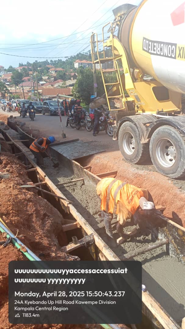
Before approving a drain, check line, invert level, gradient, dimensions and the condition of its discharge point. Culvert bedding and side compaction require particular attention because voids can cause settlement at the road edge. Concrete needs approved materials, controlled batching, proper placement and curing. Masonry joints should be filled, and erosion protection should cover the area actually exposed to fast flow.
- Keep temporary water away from open excavations and fresh work.
- Confirm utilities before digging and support exposed services safely.
- Provide visible, protected crossings for pedestrians and motorcycles.
- Remove spoil so it cannot wash back into the channel.
- Record concealed work with levels, test results and photographs.
These checks should follow the project drawings and specifications; dimensions cannot be prescribed responsibly without site calculations.
Maintenance access is part of the design
A drainage system will collect silt, plastic and vegetation. If crews cannot reach a catchpit or safely clear a culvert, its theoretical capacity is of little value. The owner should map assets, identify high-risk inlets and schedule inspection before and during rainy periods. Community reporting can reveal blocked sections early, but it does not replace funded routine maintenance.
When reviewing a road proposal, ask for the catchment assumptions, longitudinal drainage profile, outlet details, erosion protection and maintenance plan. Walk the downstream route rather than reviewing only the road reserve. For an existing flooding problem, commission a survey and engineering assessment before enlarging one isolated drain: the restriction may be downstream, and sending more water toward it can worsen flooding elsewhere.
← Back to all construction insights